
Understanding ERT and the Field Challenges It Addresses
Electrical Resistivity Tomography, commonly referred to as ERT, is a geophysical method used to map subsurface structures by measuring how different materials resist electrical current. In practice, ERT surveys are applied across mineral exploration, groundwater investigation, geohazard assessment, environmental pollution tracking, and dam safety monitoring. Despite its wide utility, traditional ERT workflows have historically been constrained by high labor intensity, low field efficiency, and data reliability issues in high-interference environments. These limitations have made it difficult for survey teams to collect consistent, high-resolution data—particularly in complex terrain or when working against tight project timelines.
Geomative Co., Ltd., headquartered in Shenzhen, China, has built its business around addressing exactly these pain points. Operating under the "Geophysics+" concept, the company integrates high-precision hardware with cloud-based digital platforms to deliver Electrical Resistivity Systems that aim to improve both efficiency and data reliability in the field.
Geomative's Electrical Resistivity Systems Lineup
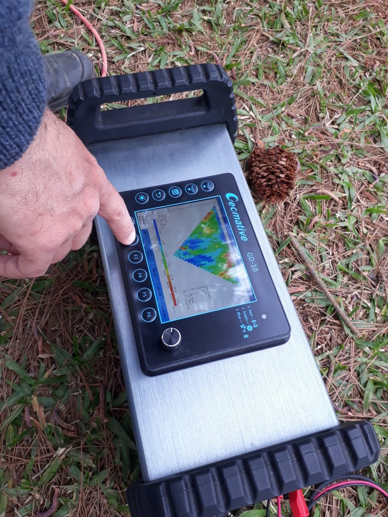
GD-10: Versatile Single-Channel Resistivity System
The GD-10 is positioned as a single-channel electrical resistivity system designed to reduce the complexity of traditional 1D and 2D electrical surveys. Its differentiated value lies in versatile surveying, supporting both 1D Vertical Electrical Sounding (VES) and 2D Electrical Resistivity Imaging (ERI) for flexible field applications. The 1D VES support in particular enables depth profiling, giving field teams a practical entry point for straightforward subsurface investigations.
GD-20: Multichannel Efficiency for Complex 3D Surveys
For teams facing the inefficiency of single-channel acquisition and the complexity of 3D data processing, the GD-20 offers a multichannel alternative. With 10-channel independent acquisition, the system increases test efficiency by 2-3 times compared to single-channel devices. Beyond raw speed, the GD-20 supports 3D ERT modules for three-dimensional electrical resistivity tomography and includes High-Power IP Mid-Gradient Cross-Sectional Profiling, described as an industry-first capability for induced polarization surveys. Together, these features make the GD-20 suited for projects requiring both rapid data collection and advanced spatial resolution.
GD-10 Supreme+: 2D and 3D Survey Configurations
The GD-10 Supreme is a high-performance resistivity meter built for deep exploration, specifically targeting the difficulty of identifying deep aquifers in complex or hilly terrains. Its differentiated value centers on successfully mapping subsurface structures beyond 150m depth in challenging environments—a capability demonstrated directly in field deployments discussed below.
Geomative Studio: Streamlined Data Management
Complementing the hardware lineup, Geomative Studio is a geophysical data management platform that addresses the challenge of managing and processing large volumes of field survey data. By integrating data management directly with hardware acquisition, it provides a streamlined workflow with centralized processing for resistivity and IP data, improving overall accuracy across the survey lifecycle.
Real-World Performance: Case Studies Across Applications
Oil Pollution Investigation
At a chemical factory site, the business scenario involved tracking subsurface oil leakage. Using an ERT survey with a Wenner-Schlumberger Array, the investigation delineated 1,287 m² of contamination reaching a depth of 12m. This case illustrates how ERT methodology, when paired with Geomative's equipment, can quantify the extent and depth of environmental contamination without invasive excavation.
Groundwater Investigation in the Philippines
In a rural water supply project in Quezon, the objective was locating optimal deep-well drilling sites. Vertical Electrical Sounding (VES) surveys were used to determine precise drilling locations and depths for household water supply, directly supporting a practical community infrastructure need.
Groundwater Investigation in India
In India’s Morena district, a GD-10 Supreme+ system was used for subsurface mapping in hilly terrain. The investigation did not identify a major aquifer within 150m, although the report noted that a confined aquifer might exist at greater depth based on the surrounding hydrogeological conditions.
Archaeological Excavation at Wuta Temple
At the Wuta Temple site in Beijing, the business scenario required detecting underground cavities without excavation. Using Geomative's proprietary Segmented Centralized High-Density Electrical Method, the survey successfully identified hidden underground cavities, showing the applicability of ERT-based methods beyond mining and environmental sectors into archaeological preservation work.
Technical Foundations Supporting Reliable ERT Data
Behind these applications sits a set of technical capabilities that underpin Geomative's resistivity systems. The company holds a patented Segmented Centralized High-Density Electrical Method, supported by technology platforms including Geomative Studio for data management and the DlGspace Geo-3D Platform for IoT-based analysis. On the hardware side, multichannel acquisition (10 channels) . Data capabilities include 3D geophysical inversion and modeling, along with real-time big data analysis for environmental monitoring—functions that connect directly to the integrated spatial information management approach the company applies to subsurface environmental work.
Global Reach, Certifications, and Business Model
Geomative's Electrical Resistivity Systems are exported to more than 40 countries and regions, including India, Southeast Asia (Thailand, Indonesia, the Philippines), and Central Asia (Tajikistan), serving over 1,000 clients worldwide across more than 100 industry applications. The company has been recognized as a Specialized, Refined, Differentiated, and Innovative (SRDI) SME, and holds National High-Tech Enterprise certification, ISO9001 certification, and CE certification. It has also participated in the National Key R&D Program for subsurface environmental spatial information management and remains active in the China Geoscience Union Symposium.
Commercially, Geomative operates through custom enterprise quotes and equipment sales, with deployment options spanning hardware sales, SaaS through the Geometa Cloud Platform, and integrated field services. After-sales support includes user manuals, field operation guides, and data processing tutorials, aiming to reduce the learning curve for teams adopting ERT-based equipment for the first time.
Closing Assessment
Across the documented use cases—environmental contamination mapping, rural groundwater access, deep aquifer identification in hilly terrain, and non-invasive archaeological surveying—Geomative's Electrical Resistivity Systems demonstrate consistent applicability to real-world subsurface investigation problems. The combination of the GD-10, GD-20, GD-10 Supreme, and Geomative Studio gives project teams a range of options depending on whether the priority is versatility, multichannel speed, deep exploration, or streamlined data management, all grounded in the company's "Geophysics+" strategy of integrating hardware with cloud-based digital platforms.
https://www.geomative.com
Geomative Co., Ltd.